Get started
GeoMultiSens
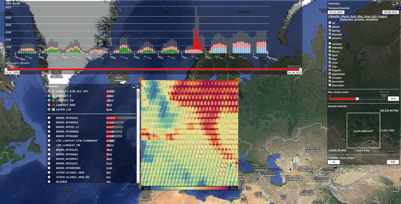
GeoMultiSens provides an integrated processing pipeline to support the analysis of homogenized data from various remote sensing archives.
1
contributor
Description
GeoMultiSens provides an integrated processing pipeline to support the analysis of homogenized data from various remote sensing archives. The processing pipeline has five main components: (1) visual assessment of remote sensing Earth observations, (2) homogenization of selected Earth observation, (3) efficient data management with XtreemFS, (4) Python-based parallel processing and analysis algorithms implemented in a Flink cloud environment, and (5) visual exploration of the results.
User group
International user community of geospatial analysts and remote sensing experts.
Features
GeoMultiSens comes with several packages (see GitLab). Its core functions are:
- Data Browser – the visual assessment of remote sensing Earth observations
- Flink Operators -- Processing large data through parallel cloud computing based on specific flink operators
Data Browser:

Participating organisations
Contributors
MS
Mike Sips