Get started
838 commitsLast commit ≈ 24 months ago2 stars0 forks
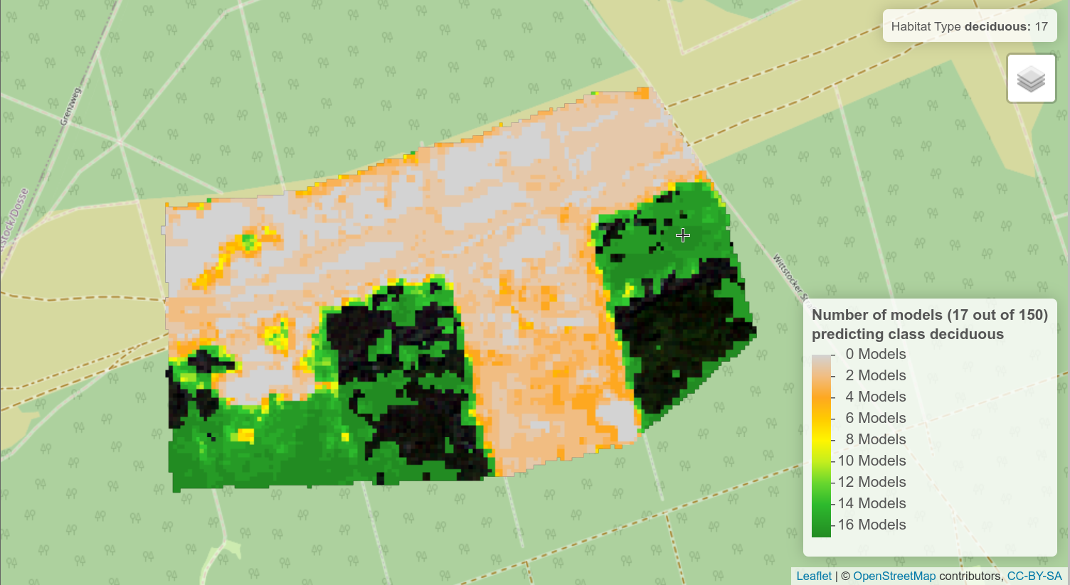
Habitat Sampler (HaSa, Community Version), an innovative tool that autonomously generates representative reference samples for predictive modelling of surface class probabilities.
Habitat Sampler (HaSa, Community Version), an innovative tool that autonomously generates representative reference samples for predictive modelling of surface class probabilities. The R package can be applied to any image data that displays surface structures and dynamics of any kind at multiple spatial and temporal scales.
The main innovation of the tool is that it reduces reliance on comprehensive in situ ground truth data or comprehensive training datasets which constrain accurate image classification particularly in complex scenes. HaSa was developed by Carsten Neumann (Helmholtz Centre Potsdam GFZ German Research Centre for Geosciences) within the context of the NaTec - KRH project funded by the German Federal Ministry of Education and Research (BMBF). For a detailed description of the Habitat Sampler and its applications, see Neumann et al., (2020).
User group
HaSa was initially developed to classify habitat dynamics in semi-natural ecosystems but the procedure can theoretically be applied to any surface. Thus, it is an important tool for scientific and municipal users in regard to remote sensing-based monitoring of various ecosystems.
Key features:
The tool is implemented in R and uses Leaflet (Cheng et al., 2019) to generate interactive maps in a web browser. There are no assumptions about the input image data and there are no constraints for the spectral-temporal-spatial domain in which the image is sampled. The tool requires the input of a priori expert user knowledge to generate reference data about expected surface classes which are delineated in the imagery or extracted from an external spectral library. The user has the choice between image classifiers random forest (RF) and support vector (SV).