All software
mobile Drilling Information System (mDIS)
mDIS is a database management application for capturing and curating meta data on geological samples, drilling progress, and related datasets such as images or geophysical well logs. It is easily adaptable and ensures that all data is compiled and quality controlled in one place.
- data management
- drilling
- Earth & Environment
- + 1
- PHP
- Vue
- JavaScript
- + 2
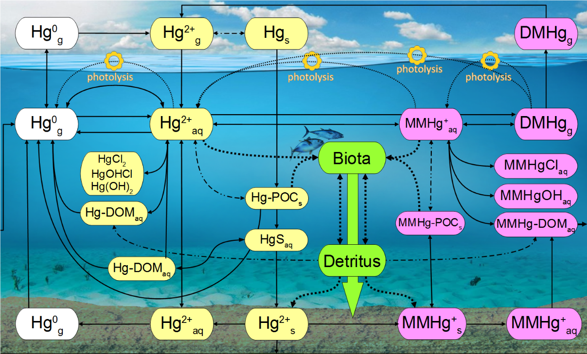
MERCY
The marine mercury cycling model MERCY v2.0 is a chemistry transport and bio-accumulation model for mercury (Hg). It implements all known processes for marine (pelagic and benthic) Hg cycling into a biogeochemical 3D ocean-ecosystem model. https://gmd.copernicus.org/preprints/gmd-2021-427/
- Bioaccumulation
- Chemistry Transport Modeling
- Earth & Environment
- + 6
mHM
The mesoscale Hydrologic Model (mHM) is a well established hydrological model used by the scientific community. It is under active development with dozens of contributors and has an open community always interested in discussions.
- Earth & Environment
- mesoscale hydrologic model
- mHM
- + 2
- Fortran Free Form
- CMake
- Python
- + 1
Miniproj
Geographic coordinate projections between projected coordinate systems and their underlying geographic reference systems as defined by the European Petroleum Survey Group Geodesy.
- Earth & Environment
- Rust
O2A SEQUENCES
O2A SEQUENCES provides a single platform for the full metabarcoding lifecycle: it keeps samples, metadata, and sequences linked, runs containerized workflows that produce provenance-tracked ASV tables, generates submission-ready exports for public archives, and delivers AI-ready outputs.
- bioinformatics
- Data analysis
- data managment
- + 7

ODM2SMS
A tool to migrate sensor metadata from the observation data model to the Helmholtz Sensor Management System via API.
- Earth & Environment
- metadata
- Research Data Management
- + 1
- Python
- PLpgSQL
- Dockerfile
OSADCP Toolbox
Open-source Python toolbox called OSADCP for scientists to convert, clean, calibrate and organize binary raw vessel-mounted Acoustic Doppler Current Profiler (ADCP) data for scientific use. The toolbox is designed to process ADCP measurements in deep water by Teledyne RDI Ocean Surveyor ADCPs.
- Data Visualization
- Earth & Environment
- FAIR Data
- + 5
- Python
- MATLAB

otter
The otter Framework combines community network analysis using Co-Occurrence networks, Louvain Clustering and Convergent Cross Mapping networks. Funding through the Helmholtz DataHub Initiative; project iLOVE.
- Community Dynamics
- Earth & Environment
- python
- Python
PyCast S2S
PyCast S2S is a collection of tools for post-processing climate forecasts. It is tailored towards the integration in operational workflows, allowing for automated bias-correction and forecast evaluation. PyCast is written in Python and uses state-of-the-art libraries for data processing.
- Climate forecasting
- Earth & Environment
- open source
- + 1
- Jupyter Notebook
- Python

py-cordex
py-cordex is a Python library for managing CORDEX grids, handling rotated/projection-based domains, and supporting CMORization of regional climate data. It enables compliant metadata, grid generation, and integration with xarray for climate workflows.
- CORDEX
- Earth & Environment
- python
- Python
- Makefile
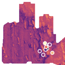
PyQuickMaps
A slim python library to link maps and sampling data with prediction methods. Needs scipy, numpy, matplotlib, pykrige, osgeo, rasterio.
- Data Visualization
- Earth & Environment
- Predictive Mapping
- + 1
- Python
SeisComP
SeisComP is a widely distributed seismological software package for real-time monitoring of earthquakes and other seismic events and provides for data acquisition, processing, distribution and interactive analysis. It has been developed within the GEOFON Program by GFZ and gempa GmbH.
- Earth & Environment
- earthquake
- seismology
- + 1